Creeks and Rivers of Silicon Valley

Fourteen: The Los Gatos Stream

Continuing the ‘Creeks and Rivers of Silicon Valley’ year long project. (Click here for complete info.)

Be sure to subscribe to this blog by entering your email in the right sidebar>>>>>

Los Gatos Creek originates in the Santa Cruz mountains, flows northward through Santa Clara Valley, and eventually feeds the Guadalupe River. As it flows through the small suburban town of Campbell, the creek feeds percolation ponds that are part of the groundwater recharge system built by the Santa Clara Valley Water District. Water held in the ponds seeps or “percolates” through the earth’s layers until it reaches underground aquifers.

The Los Gatos Plein Air group was out today painting around the creek and the percolation ponds, so once again joined them. We were very close to the intersection of highways 17 and 85. There were more painters than last Monday, around ten or so.

Click here for a map of all painting locations.

This is a wonderful place to paint! Within a hundred yard radius, you had your choice of a creek, ponds, mountains, a wide variety of trees, ducks, egrets, geese…you get the idea…all in a Silicon Valley suburb! It was somewhat overcast, but the sun would peek out frequently to light up the landscape.

I chose to paint on a pedestrian bridge that spans Los Gatos Creek. Below, a small dam backs up the water and creates a nice slow flowing spot in the creek. Others chose to paint the percolation ponds. Here are a few pictures of the day. You can click on any picture for a larger version.

Some painted along the percolation ponds.
Some painted from the pedestrian bridge.

My easel is on the left.

A view of the bridge I was painting from.
A view of the bridge I was painting from, along with the small dam on Los Gatos Creek.
An egret takes wing by one of the percolation ponds.

Just beyond the pond you can see California Highway 17, otherwise known as the Santa Cruz highway.

Here is plein air painting number fourteen:

The Los Gatos Creek 8x10, oil on panel
The Los Gatos Creek 8×10, oil on panel

I chose to include the office building in the background to indicate we were right by an office park. The building was the offices of South Bay Development Company. In the middle ground, the flat top of the levee is the Los Gatos Creek Trail.

It was a great day painting, and I hope to join the group again next Monday painting Alamitos Creek.

Fourteen: The Los Gatos Stream Read More »

Thirteen: Adieu Twenty Thirteen; Bienvenu, Twenty Fourteen

Tuesday afternoon, it suddenly hit me I should paint the last sunset of 2013, and then finish it in 2014. We had a New Year’s party to go to later, but I had enough time to go out, set up, get the basic color notes, watch the sunset, and then finish the painting the next day in 2014. Painting sunsets en plein air is tricky as right after the best part, it becomes too dark to paint! You have to make color notes, and then finish the painting another time.

I went to Norwood Creek at the corner of White Road and Norwood Avenue. Most of Norwood Creek flows under Norwood Avenue, but emerges at this intersection, where it is just a channel and terminates in Thompson Creek. Some of you know I started and sold a software company in the nineties, and our offices were on this corner, behind where I was painting. It’s also about the closest ‘creek’ to my home.

My easel set up on White Road.
Looking across White Road.  You can see my easel right behind the light pole.
Looking across White Road. You can see my easel right behind the light pole.
The scene as I painted.

Eastridge Shopping Mall is in the far distance.

Below is the finished painting.

Adieu 2013; Bienvenu, 2014 8x10 oil on panel
Adieu 2013; Bienvenu, 2014 8×10 oil on panel

Happy New Year Everyone!

Thirteen: Adieu Twenty Thirteen; Bienvenu, Twenty Fourteen Read More »
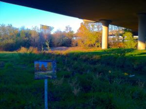
Twelve: With the Los Gatos Elves

The Los Gatos Plein Air Group was out painting today by Coyote Creek, so I joined them for painting number twelve. They meet every Monday morning, and I used to paint with them fairly frequently, but haven’t much the last few years. It was great to see old friends again, and I think the first hour was spent just chatting and catching up! BTW, I would have liked to title them ‘Masters’ in this blog entry, but trying to keep up the cutsey rhyming titles…we are all elves.

We painted by Coyote Creek about ten miles upstream from Eleven: Christmas Day, also on Coyote Creek, but in a more rural area. This is probably the furthest south I will paint for this project, even though some consider Silicon Valley to extend even further south to the agricultural towns of Morgan Hill, San Martin and, Gilroy, which have become bedroom communities for Silicon Valley. These towns reside in Coyote Valley, considered a narrowing of Santa Clara Valley (AKA Silicon Valley), and the watershed for Coyote Creek.

Nearby, is IBM’s, Silicon Valley Lab (formerly known as the “Santa Teresa Lab”), of which and I have a number of friends either working, or have worked there.

Click here for a map of all painting locations.

It was a relatively small crowd for the Los Gatos Group with about half a dozen of us. Here are a few shots–

One of the Los Gatos Group painting by one of the ponds fed by Coyote Creek.
A local horse stops to see Rebeccah's painting.
A local horse stops to see Rebeccah’s painting.

A painting of the large pond which Coyote Creek flows into and out of would have been nice, but decided to stick to the stream for project’s name sake.

I painted the spot where Coyote Creek flows out of the pond.
The Los Gatos Elves,  8x10, Oil on panel
The Los Gatos Elves, 8×10, Oil on panel

The group has a couple more stream locations on their agenda coming up soon, and I hope to join them again as weather and locations permit.

I may have picked the wrong year to do this project! By this time, the valley usually gets a few Pacific storms dumping enough rain to start many of the smaller streams, but so far this year it has been totally dry. But, like I said in the beginning, there is no lack of subject matter, and that still holds true. Even though we have had wonderful weather, I am hoping for rain!

Twelve: With the Los Gatos Elves Read More »

Eleven: Christmas Day


Continuing the ”Creeks and Rivers of Silicon Valley” year long quest.

Subscribe to this blog by entering your email in the right sidebar>>>>>


With our only son out of the country, and the family get-together set for later today, I decided to go out and do a morning painting fairly close to the house. Coyote Creek is actually a river and the largest watershed which flows through Santa Clara Basin, AKA Silicon Valley. I painted right by Hellyer Park, right under the Hellyer Avenue bridge.

Since it is Christmas Day, I’ll keep this post short with just a few pictures. I will be painting more of Coyote Creek, so will talk about it more in the future.

My easel painting Coyote Creek by Hellyer Park
Painting Coyote Creek under the Hellyer Avenue Bridge
Christmas Day, 8x10, oil on panel
Christmas Day, 8×10, oil on panel

Eleven: Christmas Day Read More »

Nine, Ten: Charlie Chaplin

Most know the story of Charles Chaplin who went to Hollywood in the early days of the motion picture industry, invented the “Little Tramp” character, and went on to be one of the biggest all time stars in cinema, at least in that era. Right? Well, not exactly. Charlie actually filmed “The Tramp” movie and others under Essanay Pictures in Niles, California in 1915. The iconic shots of the little tramp walking down a dirt road and along the railroad tracks was actually filmed in Niles Canyon. You can watch the entire movie here.

At the time, Niles Canyon with it’s railroad, Alameda Creek and other interesting terrain, was a major draw, and maybe close to becoming the film capital of the world, but Charles settled in Hollywood and Niles eventually became a suburb of Fremont. The railroad tracks though the canyon were the western termination of the transconinental rail of the US, and is still used today.

Train Trestle in Niles Canyon.

If Portola Valley is the bucks and brains of Silicon Valley, then Union City, Fremont and Milpitas could be called the valley factory. This is where many of the manufacturing and warehouses for the area are located…at least before much of it was shipped off to China!

I spent the day in Niles Canyon and did two paintings. One of my biggest problems in this project I am battling is getting access to the water. In the entire 6 mile drive between Sunol and Niles, there are only a few spots not marked “No Stopping”, “No Parking”, “No Tresspassing”, and/or fenced off.

I eventually found a turnout with a highway call box, so of course you could park there!

Painting under the highway in Niles Canyon

Here is a short video of Alameda Creek by where I painted. You could be almost anywhere in the wilds, but I was just a few miles from Silicon Valley suburbia! What an office!

Here is the painting. I kept some of the bridge in and am pretending it is a railroad trestle, as there actually was one right around the corner. You can click on any picture to view a larger size.

Charlie Chaplin I , 8x10, oil on board
Charlie Chaplin I , 8×10, oil on board

Lunch was in downtown Niles (now part of Fremont), where some of the buildings from Chaplin’s era are still standing, most of them turned into antique and memorabilia shops.

Niles, California
Niles, California

The next painting was right at the mouth of the canyon as it opens into the town of Fremont, and the greater bay area. This was a little easier access as there is a little park and a parking lot, called the Niles Staging Area.

Along Alameda Creek at the entrance to Niles Canyon
I set up the easel on the Alameda Creek bike trail
Charlie Chaplin II , 8x10, oil on board
Charlie Chaplin II , 8×10, oil on board

Niles Canyon is one of the most beautiful places in the bay area and it is sad due to man’s carelessness and abuse that most of it is now blocked from the public. I used to live nearby and drive through the canyon coming and going to the Sierras for painting and camping, all the while thinking this little canyon is as pretty as anyplace in the wilderness.

This is about as far north as I will paint on the eastern side of the bay, and probably the upper limit of what they call Silicon Valley. A map of each painting location can be found here.

Nine, Ten: Charlie Chaplin Read More »

Seven: Nuclear Heaven, Eight: Venture Capital State

Portola Valley seems like a sleepy little valley town with it’s equestrian centers, trails, redwood groves, quaint small shops, old wooden bridges, rural roads, and wonderful little creeks. In reality, it is an affluent bedroom community for the bucks and brains of Silicon Valley. You would never know just a couple miles over the hill is the brain trust and money bags of Silicon Valley. It was recently rated one of the top Elite Zips in the US which you can find here. The valley is situated just west of Interstate 280 (Locally known as the Juniper Serra, “The worlds most beautiful freeway”), close to Stanford University, and Sand Hill Road, where many of the big venture capital firms reside. The Stanford Linear Accelerator (SLAC for short), is right next door where they smash nuclear particles to determine the origin of the universe. It’s also right on top of the San Andreas Fault Line, the main earthquake generator in California!

I did two paintings in the area, the first of a little creek, which I didn’t know the name of, but was close to the west end of the two mile long SLAC.

In Portola Valley close to the Stanford Linear Accelerator
My easel along Portola Road.

I couldn’t set up right by the scene I was painting which was from the bridge you see on the left, so had to set up across the road and occasionally walk over to get details on what I was painting.

Lunch was at the Alpine Inn, best described as a biker bar, where they serve deliciously greasy hamburgers and other fare.

Alpine Inn on Alpine Road, Portola Valley

My second painting was of Los Trancos Creek where I happened upon an old, little used, but in seemingly good repair, footbridge. A local stopped by and told me the name of the creek, otherwise I would have never known!

Los Trancos Creek, Portola Valley
My almost finished painting along Los Trancos Creek.

Below are the two paintings of the day. There is still a lot of fall colors around, especially on the ground now in the form of decaying vegetation.

Nuclear Heaven, 8x10, oil on panel
Nuclear Heaven, 8×10, oil on panel
Venture Capital State, 8x10, oil on panel
Venture Capital State, 8×10, oil on panel

I will probably return here before the project is complete, and paint down San Francisquito Creek which runs easterly through Palo Alto, by Stanford University and into the San Francisco Bay. Like I said in the beginning, the least of my problems in this project is finding places to paint! This is also as far north up the San Francisco Peninsula I will paint, at least for the time being.

I just returned from a week in Denver, attending an art workshop by Jay Moore, and visiting my brother and family. I am still a couple paintings ahead of schedule, though. During some of these outings which are a bit of a drive (like today), I will probably do a couple paintings.

Seven: Nuclear Heaven, Eight: Venture Capital State Read More »

Six: The Downtown Sticks

I spent my teens and twenties in a small town in the piney woods of East Texas, around the environs of Big Sandy to be exact. Back then most people considered us ‘living out in the sticks‘, or way out in the country or backwoods. I had friends though, that lived even further “out in the sticks”.

This painting is out in the sticks right by downtown San Jose. I painted it from under the Taylor Street bridge near Guadalupe Parkway (Hwy 87) just on the northern edge of downtown San Jose. The creek is a side channel of the Guadalupe River as it flows through downtown San Jose. The fall color is still hanging around a bit, and I will continue to look for spots with color.

In case you missed it, I started a map you can follow with all the locations painted which you can find here.

Under the Taylor Street Bridge
My easel with the almost complete painting.  By the time I finished, the sun was almost set, and of course the light totally changed.
My easel with the almost complete painting. By the time I finished, the sun was almost set, and of course the light totally changed!

You can see Guadalupe Parkway in the back (have to touch that up a bit!), and the Taylor Street bridge and support column.

The Downtown Sticks 8x10 oil on board
The Downtown Sticks 8×10 oil on board

I am starting to introduce man’s mark in the Valley of Heart’s Delight, which is one of the points of this project. Sometimes people (or at least a lot of city folks) don’t realize the natural beauty right below the freeway bridges, in back alleys and other ‘hidden’ places.

I am already about 3 paintings ahead of schedule but have some prior commitments the next few weeks so may not do anymore for awhile. Stay tuned!

BTW, I hadn’t originally planned on using the cutsy titles, but will keep it up when appropriate.

Six: The Downtown Sticks Read More »

Four: Victorian Lore, Five: Just Down the Drive

Alum Rock Park sits in the foothills just east of San Jose. Founded in 1872 with its dozens of mineral springs, it soon became nationally famous as a health destination. Stone grottos were built around 20 springs, along with bath houses, hotels, saloons, a zoo, and other facilities over the years. In the late 1800’s and early 1900’s, San Jose residents and others could take the trolly from downtown east to commune with nature, partake of the mineral baths, and other attractions. All that is gone now except the stone bridges, grottos, and stairways. The park has basically ‘returned to nature’. More history can be found here. Here are a few historic photos of the park. Click on any image to see a larger version.

Alum Rock Park is a little over 7 miles from my home and Penitencia Creek flows through the park, the subject of painting number four. I painted one of the old stone bridges (built in 1913) in the afternoon. A few deer and a flock of wild turkeys kept me company for awhile. Here is a link to the location.

Alum Rock bridge over Penitencia Creek.
The almost finished painting on the easel.  There was no direct light in the canyon by the time I completed the piece.
The almost finished painting on the easel. There was no direct light in the canyon by the time I completed the piece.
Victorian Lore 8x10 oil on panel
Victorian Lore 8×10 oil on panel

There is a lot to paint here and I would like to return soon before all the fall color is gone, but also need to start covering more streams!

Painting five is just outside the entrance of the park along Penitencia Creek. Eucalyptus trees always make great subjects as they reflect a lot of the local light. I painted right along Penitencia Creek Road. Here is a link to the location.

The scene along Penitencia Creek.
My easel along Penitencia Creek close to the entrance to Alum Rock Park.

In the painting, you can see the road bed in the middle background, and a bit of suburbia in the background.

Down the Drive (Penintencia Creek) 8x10 Oil on board
Down the Drive (Penintencia Creek) 8×10 Oil on board

There are also a lot of good spots to paint along the creek outside the park, but will hold off as a backup in case I run out of ideas in other areas in Silicon Valley.

OK, I confess. I went to Alum Rock Park on Monday, but it was closed, so did painting number five just outside the park. I returned on Tuesday and did painting number four. I thought the title was catchy so reversed the order. I never said I would number them exactly chronologically!

Four: Victorian Lore, Five: Just Down the Drive Read More »

Two, Three: Woz Way

Woz Way was named after Steve Wozniak, one of the founders of Apple Computer, the inventor of the Apple 2 and other wonderful inventions Apple produced in their early years. Woz Way wraps around the Childrens Discovery Museum situated near the south end of downtown San Jose. As I recall, Woz contributed heavily to the museum, and continually contributes both monetarily and personally in the area. He is a local hero.

I did this painting sitting under the overpass of Woz Way, right near the intersection of Interstate 280 and Hwy 87. Up to the left you would find the Childrens Discovery Museum of San Jose. To my back is the freeway interchange of I280 and 87. The Guadalupe River Trail is where my easel is sitting. Here is a link to the location.

This is the southern end of the Guadalupe River Park Area which runs right through the middle of San Jose, and I will try to do a few more in the next week or so along the Guadalupe to capture the fall color.

Painting under Woz Way
Woz Way  8x10 Oil on board
Woz Way 8×10 Oil on board

I scraped the stream three times, and wonder if I should scrape it again.

I also tried to explore more along the Guadalupe River Trail, but much of the access to the river is restricted and posted ‘by permission only’, presumably to keep the homeless from building camps. I guess I will have to check with the city of San Jose to get permission into some of these areas.

The third painting is of Thompson Creek a few miles upstream from painting number one, close to the intersection of Aborn and White Rds, and just a few miles from my house.

Along the banks of Thompson Creek

Silver Creek II 8x10 oil on board
Thompson Creek 8×10 oil on board

Here is a link to the location.

One thing I am learning early on is I a will have to do many more than 52 paintings to get a good body of work. The paintings above needs something, but I can quite put my finger on it. Anybody have any suggestions? Too busy? Not enough contrast?

Update: This was originally named Silver Creek II, but is actually Thompson Creek which flows into Silver Creek. I updated this post accordingly.

Two, Three: Woz Way Read More »